Drone Mapping
Find out more
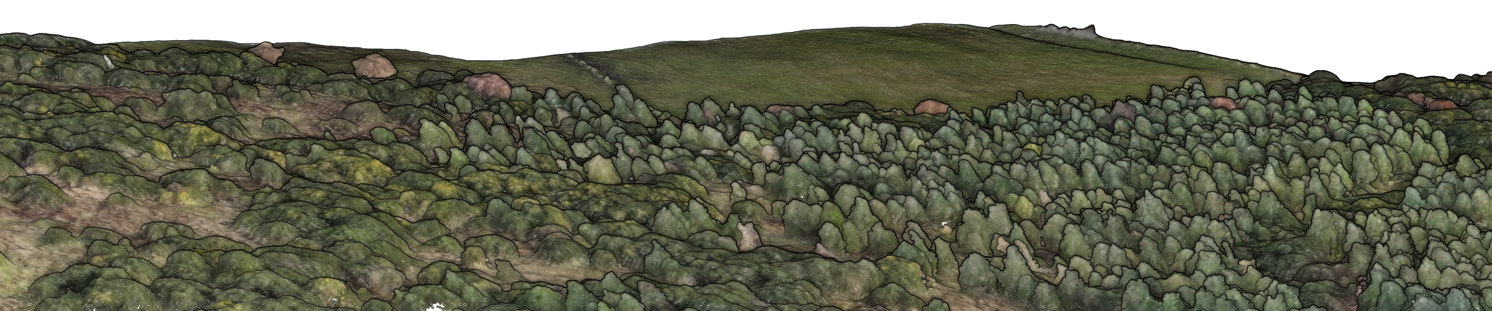
I’m a certified and insured drone pilot, holding a General VLOS Certificate (GVC) issued by the Civil Aviation Authority (CAA). I collect and process orthorectified aerial imagery, photogrammetry point clouds and elevation models.
Deliverables
RGB Orthomosaics
Multispectral Orthomosaics
3D Models & Point Clouds
Digital Terrain Models, Digital Surface Models and Canopy Height Models
Vegetation Indices (NDVI, GNDVI, NDRE)
Tree Counting
Digitisation: I use drones for forest subcompartment mapping & ground preparation measures alongside digitisation of habitats and landscape features.
Geospatial Services
Find out more
I can process and visualise your spatial data.
Deliverables
Maps: Data visualisation and interpretation.
Web Mapping: Host your spatial data online using interactive web maps that can be easily shared or embedded in your website.
Shiny Applications
QGIS Plugins: I create custom processing plugins for QGIS that can automate your GIS workflows, all hosted in a private QGIS repository for convenient distribution and updates.
Photogrammetry & LiDAR: Processing, classification and analysis.
Hydrology: Topographic hydrological analysis to support peatland restoration operations.
Ecological Site Classification (ESC): Make full use of your habitat and/or soil surveys to assess woodland creation opportunities in high spatial detail using a straightforward map interface.
Machine Learning
Find out more
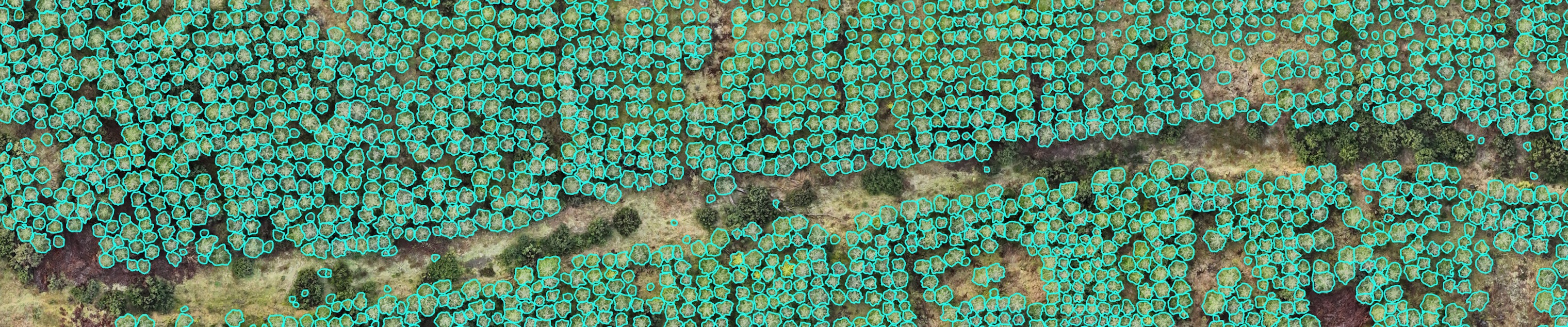
AI has enabled highly detailed information to be extracted from drone imagery at remarkable speed, accuracy and scale. I train and deploy deep learning models to detect trees, with a comprehensive analysis pipeline extracting valuable spatial insights for each of them. Results are provided in an interactive map.
Deliverables
Individual Tree Detection: Accurate tree counts, stocking density and heights.
In development
Woodland carbon estimates
Terrestrial point clouds: Integrated with individual tree analysis pipeline to extend coverage and enable diameter at breast height (DBH) measurement.
Centerboxlabel
Landscape Visualisation
Find out more
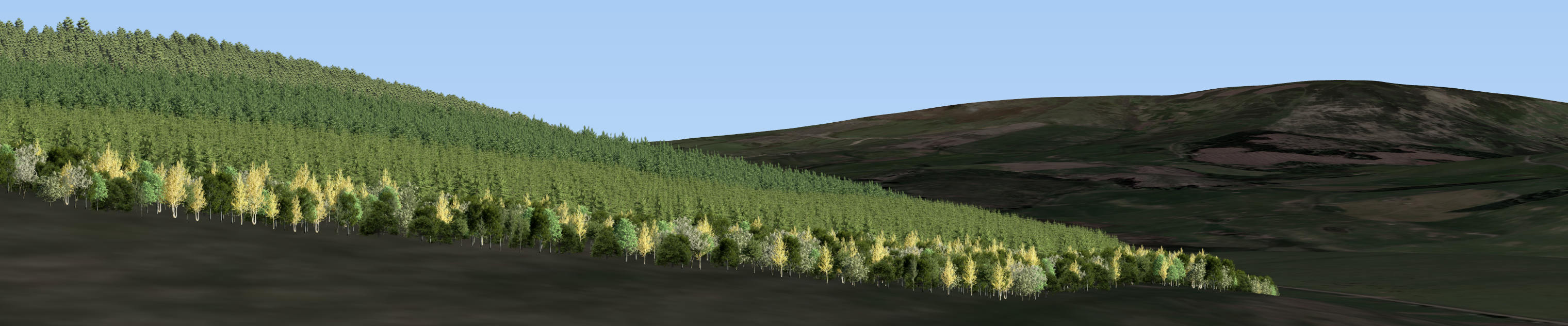
I provide 3D woodland visualisations for landscape appraisals and consultations. Different viewpoints and stages through time can be visualised accounting for proposed establishment method, species assemblage, density, age, site operations, roads and fences.
Deliverables
3D Landscape Visualisations
Viewshed Maps
Please get in touch to find out more.