Card1
I specialise in drone remote sensing, spatial data analysis, machine learning and geographical information systems (GIS). I’m open to a variety of work; you can find some of my services listed below. Please don’t hesitate to get in touch. I offer discounts to community organisations and charities.
Mainpanel
Drone Mapping
find out more
I’m a fully insured, CAA-certified drone pilot offering aerial ortho imagery and photogrammetry services across the UK. I can help extract the most from your drone data by processing or analysing survey outputs according to your needs.
Centerbox
Orthomosaics ◦ 3D Models ◦ Digital Elevation Models ◦ Spatial Analysis ◦ Canopy Height Models ◦ Multispectral ◦ Vegetation Indices ◦ RTK
Mainpanel
Geospatial Services
find out more
Whether you are looking to create web maps, require GIS support for your organisation or hope to solve more complex problems with a tailored analysis solution, I may be able to help. I use R and Python and have a broad knowledge of open-source geospatial tools.
Centerbox
Spatial Analysis ◦ Web Maps ◦ Visibility Maps ◦ Zone of Theoretical Visibility (ZTV) ◦ Hydrological Modelling ◦ QGIS Plugins ◦ Private QGIS Repositories ◦ Photogrammetry ◦ LiDAR Processing ◦ Woodland Suitability Maps
Mainpanel
Machine Learning
find out more
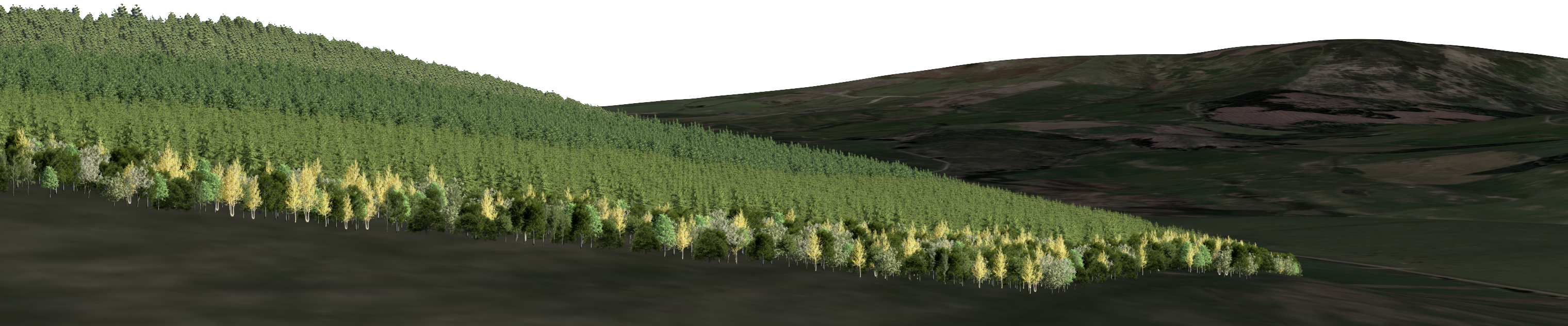
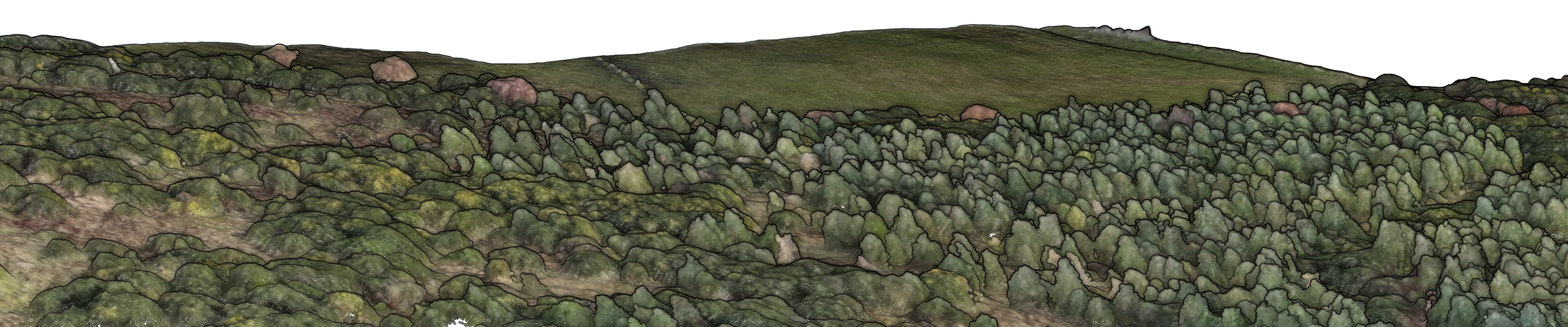
I can help extract highly detailed insights from your drone imagery using custom deep learning models and bespoke spatial analyses. Current applications include identification of individual trees at scale. My approach reports tree height, crown attributes and stem density, with biomass and carbon estimates available for testing. Please get in touch if you’re interested to find out more; I’m always open to novel use cases or collaborations.
Centerboxlabel

Mainpanel
Visualisation
find out more
Visualise woodland creation proposals in 3D at different stages in time.